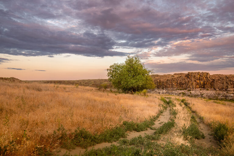
Just as winter snows shutter many of the region’s outdoor recreation destinations, the Methow Valley, a multi-sport Mecca on the dry side of the Cascades, begins its second peak season. Although the area’s Nordic ski system — the largest in the country — is justifiably acclaimed, snowshoers also have plenty to celebrate.
In addition to the valley’s extensive Nordic ski trails, the Methow Trails organization also maintains a handful of trails specifically for snowshoers. Sun Mountain Lodge, just south of downtown Winthrop, is the heart of a network of short trails that meander the rolling ridges abutting the Methow Valley. For a superb introduction to the Sun Mountain trail system, check out the 6-mile Patterson Mountain loop, which departs from Patterson Lake and wanders through scattered aspen groves and sunny slopes above the lake. Time your snowshoe for early morning or late evening to watch the ever-present Methow sun glance off the showcase peaks of the North Cascades. The Patterson Mountain loop can also be accessed from an alternate trailhead near the Sun Mountain Lodge parking lot.
However, for the best Methow experience, make your own tracks in the backcountry. Although most of the Methow’s beloved high-country routes in the Pasayten Wilderness, Chelan-Sawtooth Wilderness, and North Cascades National Park are inaccessible during the winter, several of the region’s most popular and family-friendly trails, especially those along the rivers that meander through the Methow, are easily accessible even when the snow piles up.
A word of warning: Most of the Sno-Parks listed on maps cater to, and are quite popular with, snowmobile users. On peak winter weekends, the parking lots are packed with trailers. Avoid these and seek out one of the quiet non-motorized trails of the Methow.
West of Mazama, amble up a canyon 5.5 miles roundtrip to the crashing cataract of Cedar Falls. Views through the park-like east slope pine and fir forest are infrequent, though openings in the canopy reveal the rocky prominence of the Goat Wall above the tiny town of Mazama. Meantime, enjoy the sounds of Cedar Creek cascading in the canyon below.
Looming over the town of Twisp, Lookout Mountain is a pristine island peak only minutes from SR 20. An 8-mile roundtrip snowshoe, first on forest road and then through airy fir forest, grants panoramic views of the Methow Valley and its encircling summits. Especially attractive are the snow-cloaked peaks of the Chelan-Sawtooth Wilderness to the south.
Because the Methow caters to a winter crowd, apres’-snowshoe spots are easy to find. Winthrop, which has fashioned itself in an Old West aesthetic, complete with wooden sidewalks and storefronts, is the hub for tourism and outdoor recreation in the Methow Valley. Tiny Twisp, 8 miles east of Winthrop on SR 20, has a vibrant arts community and a more laid-back charm.
Where to Stay
Lodging abounds, too, although keep in mind that winter is high season in the Methow Valley. Although the winter closure of the North Cascades Scenic Highway means travelers from the west side of the Cascades must travel some seven hours from Seattle via Highway 2, hotel rooms are in high demand. Come December, “No Vacancy” signs go up as quickly as the rates. Book well in advance, or better yet, come in March for off-peak rates and quiet trails. Try the Chewuch Inn & Cabins, whose owners, Dan and Sally Kuperberg, are serious outdoors enthusiasts and can provide trail-tested knowledge and advice. The afternoon baked goods in the spacious, wood-appointed main lodge make for a nice post-trek treat, as does the outdoor hot tub.
Snowshoe Rentals/Trip Planning
Several locations in Winthrop rent snowshoes, including Methow Valley Ski School and Rentals, Methow Cycle and Sport, Winthrop Mountain Sports, and the North Cascades Basecamp. Winthrop Mountain Sports, on Riverside Avenue in the heart of downtown Winthrop, also boasts an impressive array of outdoors clothing and equipment behind its tiny storefront. Check out the store’s extensive selection of USGS topographical maps of the region; many of the area’s forest roads are inadequately marked. To learn more, visit Methowtrails.org. //