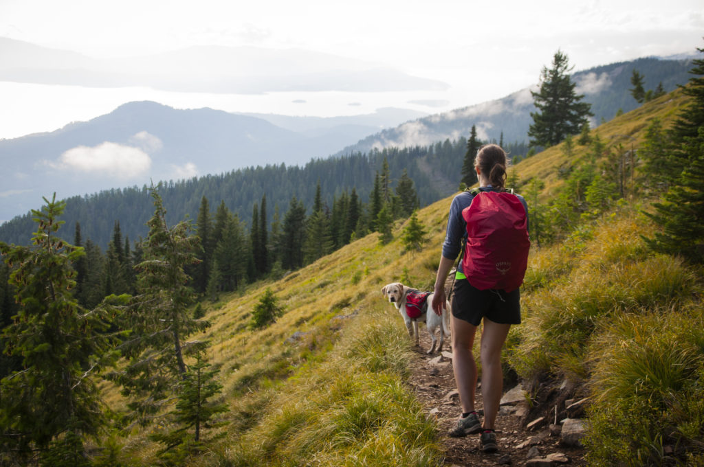
The Kettle River Range Mountains are a beautiful and remote slice of backcountry heaven in our ever growing and developing corner of Washington. Nestled between the towns of Republic and Kettle Falls just south of the Canadian border in the Colville National Forest, the Kettle Range is a place where many go to relax for a weekend in a quiet Forest Service campground and hike along uncrowded mountain trails.
Also known as the Kettle Crest or the Kettles, the mountains are a sub-range of British Columbia’s Monashee Mountains to the north, and have long been popular with hikers from the Spokane area looking for a nearby outdoor adventure fix. Despite its reputation as a classic backcountry hiking destination, the Kettles still have the feel of an undiscovered wilderness Shangri-La.
The hikes, camping, and other adventures referenced here are just a small sampling of the many outdoor adventures to be had in these mountains.
dAY HIKES IN THE KETTLE RANGE
Many of the hikes in the Kettles, especially up on the Kettle Crest, can be challenging for the occasional hiker. But even a short walk up many of these trails can lead to fantastic mountain views, wildflower meadows that can rival Manito Park’s Japanese Gardens, humbling encounters with old-growth trees older than the U.S. Constitution, and the chance to watch all sorts of birds and spot other wildlife.
Most of the hikes in the Kettle Range are within a two and a half hour drive from Spokane, making them doable as day hikes, but more enjoyable when paired with one of the recommended backcountry campgrounds to make a weekend out of it.

Columbia Mountain Lookout
The occasional sounds of passing traffic at Sherman Pass below will hardly be noticed as you soak up the views of the dramatic summits of the Kettle Crest to the south, the Cascades far to the west, and the distant peaks along the Selkirk Crest east in North Idaho.
A recently reconstructed historic fire lookout cabin that was first built in 1914, along with even better views, awaits those who push on to the top. Follow the Kettle Crest Trail north from the trailhead for about an hour and look for the spur trail on your right that accesses the summit and a loop around the mountain. Return the way you hiked up.
- Round trip: 8 miles
- Elevation gain: 1200 feet
- Difficulty: Moderate-to-difficult
Finding the Kettle Crest Trailhead at Sherman Pass: The trailhead is on your left as you drive the short access road to the main parking area, a few hundred yards from where you will park your car.
Emerald Lake & Hoodoo Canyon
After a several mile walk past towering Ponderosa pines and granite rock formations you will stumble upon aptly named Emerald Lake tucked down in this forested canyon. Take a dip or wander the shores looking for the tracks of moose, deer, bear and other wildlife.
Start hiking at the trailhead on the east side of the Trout Lake Campground, and slowly climb for several miles until you reach the junction with the steep spur trail descending down to Emerald Lake on your left. Return the way you came.
- Round trip: 6.2 miles
- Elevation gain: 650 feet
- Difficulty: Moderate (great family hike)
Finding the Trailhead: The trailhead is on the east side of the Trout Lake Campground, near the lake.

Sherman Peak Loop
The Sherman Peak loop offers a crash-course in ecology for those who take the time to look, listen, and learn what undisturbed forests have to teach us.
The 1988 White Mountain Fire left behind a forest of silver snags that are both hauntingly beautiful and part of a natural cycle of renewing wildfire that creates new habitat for wildlife—keep an eye out for owls, woodpeckers and small mammals that use these dead trees to survive.
Other parts of the mountain remained unburned by the fire, and a forest of new trees are well established along the burned flanks of the mountain. The open country and bare-rock summit of Sherman Peak offer some of the best views in the region.
From the trailhead, hike for about a half hour before reaching the junction with the loop trail and go left (east) up and around Sherman Peak, keeping to the right on the loop trail when you reach the junction with the Kettle Crest Trail that continues south.
Continue on the loop trail around Sherman Peak until you return to the Kettle Crest Trail and head back to the trailhead the way you came.
- Round trip: 5.3 miles
- Elevation gain: 900 feet (more if you scramble to the summit)
- Difficulty: Moderate-to-difficult
Finding the Kettle Crest Trailhead at Sherman Pass: From the parking area, walk across Highway 20 to the south side and head east looking for the trailhead on your right a few hundred yards down the top of the pass.
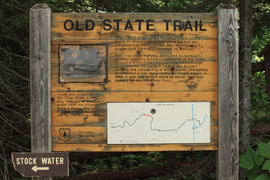
Old Stage Trail to Copper Butte
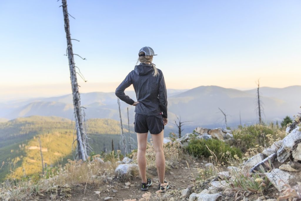
Hiking along the old wagon route up to the Kettle Crest, which served as Washington’s first state “highway” over 100 years ago, is a chance to experience a piece of our frontier heritage first hand. For hikers fit enough to make the final push along the Kettle Crest Trail up to 7,135 foot Copper Butte, expansive views from the highest peak in the Kettle Range are your reward.
Hike 1.7 miles from the trailhead to the junction with the Kettle Crest Trail, which you will hike on heading south for another steep 1.2 miles to the summit of Copper Butte. Return the same way you hiked up.
- Round trip: 6.5 miles to the summit and back
- Elevation gain: 1,635 feet
- Difficulty: Strenuous to the summit, only moderate to the Kettle Crest Trail junction.
Finding the Trailhead: The trail starts near a trail sign, fence and outhouse—you can’t miss it.
GROUP DAY HIKES
Both Conservation Northwest and the Spokane Mountaineers have been offering volunteer-led conservation themed hikes in the Kettle Range and other wildlands of the Colville National Forest for years. So if you’re looking for a group of like-minded hikers to share a trip to the Kettles with, check them out online at conservationnw.org and spokanemountaineers.org.
Or try one of several new hiking clubs that have started over the past few years, like the Burning Boots Trail Club (www.meetup.com/BurningBootsTrailClub) or Inland Northwest Hikers (www.meetup.com/Inland-Northwest-Hikers).
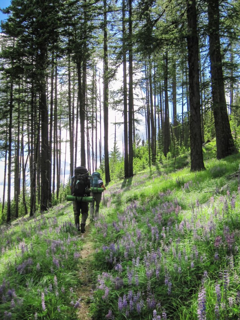
kETTLE CREST BACKPACK TRIPS
The best way to truly experience and appreciate the scenery and solitude of the backcountry is to immerse yourself in the place over a multi-day backpack trip—to wander the woods, ridges and meadows until your clothes smell like sagebrush and pine, and you find yourself invariably staring off into vast expanses of uninterrupted mountain and sky.
The Kettle Crest, which includes well over a dozen peaks in the 6,000 to 7,000 foot range and nearly 45-miles of trail along the Kettle Crest National Scenic Trail, has enough wilderness real estate to keep you hiking for days.
In addition to these two recommended trips on the Kettle Crest, there are many options for creating your own backpack trip routes by linking up various feeder trails with portions of the Kettle Crest Trail.
kettle Crest North—Sherman Pass to Boulder Pass
The Kettle Crest North Trail is a 30-mile expanse of road-free hiking is a regional classic and part of the Pacific Northwest National Scenic Trail route. Plan to hike 3-4 days to really enjoy the trail and side peak scrambles.
Navigation is relatively easy since you stay on the Kettle Crest Trail the whole way; however, there are a few sections where the trail tries to trick you, and other places where cattle have destroyed the trail tread with their own network of wrong turns. And finding water and planning your camps accordingly will take some route preparation, so take maps and use your guidebook of choice.
The best way to hike the trail is from Sherman Pass north to Boulder/Deer Creek Pass, which is a paved county highway halfway between the towns of Curlew and Orient. You will need two cars to run your shuttle.
Kettle Crest South—Sherman Pass to White Mountain
This southern portion of the Kettle Crest Trail is a little less than 15 miles in length, making it an excellent weekend backpack trip option. The trail traverses several of the most dramatic peaks in the Kettle Range, including Sherman, Snow, Bald, Barnaby Buttes and White Mountain.
The hike passes in and out of remnants of the 1988 White Mountain fire and unburned forest. This hike takes you by the Snow Peak cabin, a Forest Service rental cabin, as well as a couple of water sources. The highlights of this hike are the striking scenery, solitude and opportunities to stumble upon wildlife.
Leave a car at the White Mountain trailhead, and start your hike from Sherman Pass Kettle Crest Trailhead.
BACKCOUNTRY CAMPING
One of the easiest and most relaxing ways to experience the wilderness character of the Kettle Range is to plant yourself for the weekend at one of these off-the-beaten path car-camping spots. All three of these campgrounds are primitive, quiet, and beautiful, and offer hiking trails right out of camp.
While facilities are limited to an outhouse, a few picnic tables and easy trailhead access (bring your own water!), they are also free and generally uncrowded or empty. For more info on other campgrounds in the area, visit www.fs.fed.us/r6/colville/recreation.
Trout Lake Campground
A beautiful camping area shaded by sweet smelling cedar trees on the shores of Trout Lake. Hiking Hoodoo Canyon and fishing are the main draw (no gas motors allowed on the lake).
Jungle Hill Campground
Campsites near the creek help drown out the occasional sound of trucks driving along Sherman Pass below. The dreamy lodgepole forest and views up towards the Kettle Crest are captivating. Hike the Jungle Hill Loop Trail up to the Kettle Crest from here.
Wapaloosie Campground
There are fewer camp spots here, but the campground is farther from the highway, has a nice creek, a couple picnic tables, and access to the Kettle Crest right out of camp via the Wapaloosie Trail.
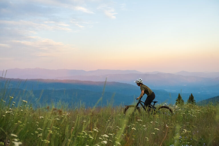
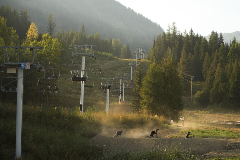
MOUNTAIN BIKING & TRAIL RUNNING
If adrenaline and endorphins are more your thing, the Kettle Crest area trails provide plenty of adventure for outdoor athletes on bikes and in running shoes.
All of the trails in the Kettle Range listed for hiking and backpacking in this story are currently open for mountain biking, although many of them are included in areas under consideration for wilderness protection—which would not allow motorized and mechanized vehicles, including bicycles.
While mountain bike use in the Kettles has been relatively low since the first local cyclists began testing their mettle on the rocky trails nearly two decades ago, in recent years routes like the Jungle Hill loop, Sherman Peak loop, Taylor Ridge, and the Kettle Crest Trail have become more popular.
Most of the riding on the Kettle Crest would be rated difficult to strenuous by most riders. For more information on biking routes in the Kettle Crest, visit the Evergreen Mountain Bike Alliance – Eastern Washington Chapter.
Gibraltar Trail: This newer mountain biking and hiking trail in the rolling mountains is just south and east of Republic. It’s currently under construction and will offer some of the best biking around when the final 18-20 miles of trail are completed. To learn more and help build the trail, visit Conservationnw.org.
Trail Running: The trails in the Kettles also make for spectacular trail running, with stiff climbs, fast descents and scenery that will make you drool. The hiking routes listed here make excellent shorter runs, while the full 45-mile Kettle Crest Trail will keep you running all day.
GETTING THERE – DRIVING DIRECTIONS
From Spokane, take state Highway 395 north through Colville and then through Kettle Falls (about 80 miles from Spokane). Shortly after crossing the Columbia River, turn left onto Highway 20 to reach Sherman Pass and Albian Hill Road.
Continue north on 395 for 22 miles and turn left onto county highway #602 near the town of Orient, and drive up to the top of the Boulder/Deer Creek pass to reach the Kettle Crest Trail North.
- Sherman Pass and the Kettle Crest Trail trailhead: Marked as the Kettle Crest Trail on the south side of Sherman Pass, off Highway 20 between Republic and Kettle Falls. There is a large parking area, an outhouse, trail information and a few campsites.
- Jungle Hill and Wapaloosie Campgrounds: Between Kettle Falls and Republic, 22 miles up Highway 20 from the junction with Highway 395, turn right onto the Albian Hill Road #2030. Travel north on road 2030 for 0.6 miles to trail sign and turn left (west) into the Jungle Hill campground and drive 0.2 miles to trail. To reach the Wapaloosie Campground, follow the same directions but continue past the Jungle Hill campground turnoff and continue heading north on Albion Hill Road #2030 for another 2.5 miles and turn left (west) into the signed Wapaloosie Campground and trailhead.
- Emerald Lake/Hoodoo Canyon Hike and Trout Lake Campground: At milepost 337 on Highway 20, between Republic and Kettle Falls, look for the sign for Trout Lake and head north on Forest Service Road 020. Drive for five miles to the Trout Lake campground and the trailhead.
- Old Stage Trail and Copper Butte: Follow the directions to Albian Hill Road #2030 as described for Jungle Hill and Wapaloosie Campgrounds, but drive 7 miles north from the junction with Highway 20 to the signed trailhead on your left.
- Kettle Crest Trail trailhead (north) at Boulder/Deer Creek Pass: Take county road 602 east from Curlew, or west from Orient/Highway 395, to the top of Boulder-Deer Creek Summit. The trailhead is on your left.
- Kettle Crest Trail trailhead (south) at White Mountain: From Kettle Falls, drive west on Highway 395 across the Columbia River and turn left onto Highway 20. Drive 10.4 miles and turn left onto South Fork Sherman Creek Road #2020. It’s 14.7 miles of gravel road to the trailhead. At mile 6.5, bear left onto Barnaby Cr. Rd. #2014. Stay on Barnaby Cr. Rd. until mile point 10.4 and turn right at the fork onto road #250, and drive to the end of the road to the trailhead.
PLANNING YOUR TRIP: MAPS & GUIDEBOOKS
The following guidebooks are indispensible to plan a safe, fun trip. For all of the recommended outings, you will need a Colville National Forest map, any topographic maps listed in the guidebook description, and a compass. A GPS unit doesn’t hurt as long as you know how to use it and bring paper maps as a backup.
- 100 Hikes in the Inland Northwest, by Rich Landers. Includes info on most of the day hiking and backpacking trips listed here.
- 50 Hikes for Eastern Washington’s Highest Mountains, by James P. Johnson. Includes routes to the summits of all the day hikes listed here and many more in the Kettles.
- Hiking Washington: A Guide to Washington’s Greatest Hiking Adventures, by Rod Adkison. Includes Old Stage/Copper Butte hike and others in the Kettles.
- Backpacking Washington: Overnight and Multi-day Routes, by Craig Romano. This guidebook that covers in detail both of the backpack trips listed here.
Derrick Knowles was the first senior writer for Out There when it was founded by publisher Jon Snyder. In 2013, Derrick and his wife, Shallan, became the new co-publishers.